


Columnist Sammy Sinatra
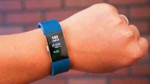
The Fitbit watch has enhanced and improved users’ workouts and routines since 2013. However, the tracking device on the Fitbit has recently caused some concerns with our military by releasing, through a Global Heat Map, probable whereabouts of military bases, running routines, supply routes and bases from the past two years.
According to the The Washington Post, “The Global Heat Map, published by the GPS tracking company Strava, uses satellite information to map the locations and movements of subscribers to the company’s fitness service over a two – year period, by illuminating areas of activity.”
The concept of tracking and releasing a Global Heat Map is not necessarily a bad idea – one can recognize it as a way to connect users. But for the military, it’s another story. The United States lights up like a Christmas tree when you analyze the Global Heat Map. In contrast, when you zoom into more desolate places in the Middle East, you see there are very few high-activity areas, especially in places of war; most specifically Syria, Afghanistan and Iraq.
Major Audricia Harris, Pentagon spokeswoman, told The New York Times, “Recent data releases emphasize the need for situational awareness when members of the military share personal information. [The Pentagon] takes matters like these very seriously and is reviewing the situation to determine if any additional training or guidance is required,” she said. Many U.S. soldiers wear Fitbits and have their tracking setting on; this is a potential problem. There is no privacy if every step you take can eventually lead to an online map with patterns of your routines.
As told by CNN, “…there also appear to be other airstrips and base – like shapes in places where neither American military forces nor the Central Intelligence Agency are known to have personnel stations.” With their locations known, the troops could be under threat if any enemies are able to see and utilize the Global Heat Map. This has the possibility to cause major problems down the road.
Many have questioned why the military sees the need to even have tracking on their Fitbit turned on in the first place. It opens up doors to threats and attacks, making them more vulnerable. In places of war and violence, there needs to be more protection. Should the responsibility for this fall on the military, or Strava? The military could have been more conscious of the programs entailed with Fitbit. On the other hand, Strava knowingly made the Global Heat Map public and posted a direct threat to our own military. New technologies lead to new unknown precautions that we need to take seriously and openly discuss.
In a statement to CNN, a Strava spokesperson said, “Our global heatmap represents an aggregated and anonymized view of over a billion activities uploaded to our platform. It excludes activities that have been marked as private and user – defined privacy zones.”
Users of all media need to be more aware of what each app or service involves when they download or sign up. There needs to be an overall understanding of what clicking “I agree to the terms and conditions,” really means. As media and technology develops, it’s important to note when one has taken lack of privacy too far, and where you need to draw the line.
